Drop-In
The Original Map of Manhattan at the Manhattan Borough President’s Office
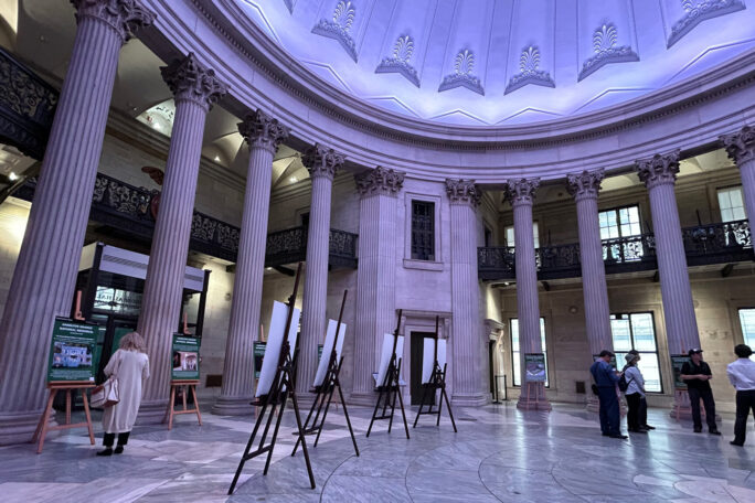
Office of the Manhattan Borough President
Civic Center, Manhattan
Sat, October 18th, 2025
10:00am — 4:00pm
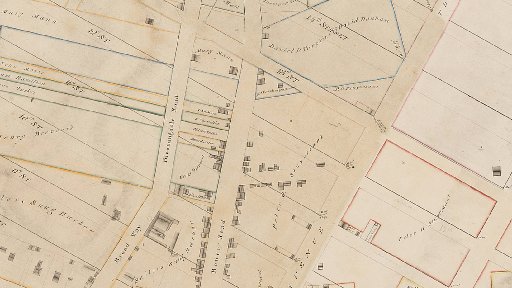
New York City's Borough Presidents are responsible for maintaining the official maps of their respective boroughs. The Manhattan Borough President's Topographical Bureau will display segments of a historically essential map in the development of Manhattan, executed by John Randel Jr. in 1820. This map is the first that plotted the 1811 "Commissioner's Plan" which established the Manhattan street grid from Houston Street to 155th Street. On display will also be other historical maps, including the Blackwell Farm map, which continued Manhattan's grid past 155th Street.
All visitors must pass through a security screening with x-ray machines and metal detectors. A chair lift to the map display room is available. Food and drink are prohibited. Children are welcome accompanied by an adult.
1820: John Randel Jr.
1 Centre Street, Floor 19th South
New York, NY, 10007
What's Nearby
Civic Center, Manhattan

Tribeca, Manhattan
Tribeca, Manhattan